Monday 25 February 2019

Mackenzie Basin and Aoraki Mt Cook

My penultimate piece of work from April to June (inc) last year, was to prepare a programme management plan and over 20 project briefs to support the implementation of recommendations from a report prepared by a consultancy specialising in strategic planning and problem solving. The report was commissioned on behalf of the five governmental agencies (local, regional and central) to identify how they could best work together to preserve and maintain the special characteristics and features of the Mackenzie Basin. The PMP and project briefs were a great piece of work to do and I had the help of Sarah, my trustee documentation specialist and a range of people from the agencies concerned who all brought knowledge of the area and their current operating environment and processes, as well as the skills and desire to work for change. It was a challenge to accomplish it within the timeframe (after all, I was on a deadline myself as I had to finish it before early July as we were heading to the UK, having delayed our trip from May to be able to get this done) and I was ably assisted by the whole group that I named the Virtual Programme Team.

Why is she telling us this, I hear you ask. Well, it's because we went through the Mackenzie Basin, which is an intermontane environment on this trip - and what David and I both realised was that we had not known much about the area beforehand. Certainly we had heard of it, and we had actually been there back in 2001. But we had no idea of how rare and special an environment it is. So driving through it this time we were much more observant and impressed. If you want to read about it and why you should come and visit it, then look at this website. Or this one.

We didn't stay and do many of the activities that are available, but driving through spectacular scenery was a pleasure. You will have to wait for David to do a photographic post to see the best ones. I will nag him ...

We stayed for the night in Alexandra having driven through Roxburgh where Jack and Sarah used to live - we couldn't see their old house on our way through, but we did see the main street, the dam and lake that we had been to with them on our visit.

The Alexandra Motorcamp was great - it is huge and has excellent facilities. It was a very hot day so I asked for a place in the shade, by the river. So down to the river-flat the woman sent us and we parked up under a huge willow tree with a view to the river - perfect! No need for the awning, a slight breeze and the sight of cool water! And until about 6pm, we were the only ones in that area, although several people came past on their way to and from a cooling dip in the river. There are photos but they are not on jy camera - I will ask David to include them in one of his photo posts.


And it is DRY down here!
The following day we headed for Aoraki Mt Cook - well, that is where we thought we were going! Until we got to Omakau instead of Clyde and realised we had headed out of Alex without checking the GPS carefully enough - no wonder it kept trying to send us up dusty gravel roads ...

So an about turn until the correct road was reached and away we went again. Doh!!
That day, we started at Alexandra, and instead of heading out on SH8, we went for about 18kms on SH85. Once back on the right track, we drove up through Clyde, Cromwell, up the Lindis Valley and through the Lindis Pass to Omarama and then on to Pukaki, and along the shores of Lake Pukaki to Glentanner than then Aoraki Mt Cook Village. You can see from the map that a lot of it was in mountainous country - and I don't just mean high hills, by the way! David will include some of the photos of this trip in his pictorial post ...


The only place available for motorhomes close to Aoraki Mt Cook was at Glentanner and we had pre-booked that while at Alex. Knowing how many tourists head to Aoraki Mt Cook we thought it was better to have a space available than to chance it.

On arrival they gave us a Reserved sign to hang on the tap, so our spot - with a view of the lake - would still be ours when we got back from our 20km drive to the village.
This was our view from the motorhome - down to Lake Pukaki

And there is Aoraki Mt Cook - what a view while eating dinner!

This is my panorama shot taken up outside the i-site at Aoraki Mt Cook village. I was waiting for David to re-appear from somewhere inside or outside - I had to text him to find out where he had got to ...
I took this on our way back from Aoraki Mt Cook - David said it was a very creative shot. I say it was lazy because I couldn't be arsed getting out of the cab while David was forced out (by me) to go and take photos ...

There are only about 500 photos of the surrounding scenery, but relax, only 450 are included. Nah, I'm joking ... As I noted above, I am going to get David to do a couple of posts of photos that he considers highlights of the trip though, because he took lots and I haven't used any of his unless he took them on my phone. I am too impatient to trawl through more than one photographic device, don't you know! And he is a much better photographer.

After dinner we walked down to the lake - it was a beautiful evening after a magnificent day.

The sunlight fading away on the mountains to our west

and the sunset

The path was full of potholes - I didn't realise on the way down that this was also part of the riverbed ...

The braided riverbed - currently dry. I doubt there'd be much walking down here in the winter!
 We had planned to have breakfast at the Glentanner Cafe before leaving the area, but they only did cabinet food and I had my heart set on a cooked breakfast. And apart from that I thought $6.50 for a re-heated cheese, bacon and onion on toast was a bit steep ... So we headed for Twizel with a stop at a lookout on the way. There are LOTS of lookouts - some we don't stop at because they are already chockablock with motorhomes and campervans.


See what I mean? And that was less than half of the parking area. Ours is there, on the left - white with a black roof. Much the poshest in the carpark ...
What's not to like? Lake Pukaki, Mackenzie Basin tussock hills across the water, mountains in the background and a beautiful skyscape - there's even tourists to add to the interest factor! I didn't include the toilet in the shot - that would have been de trop.

And while waiting for breakfast at Twizel, David said, in all seriousness "That is a very tall piece of playground equipment." Look closely, people, and to its right you will see the bottom of a lamppost; to its left, in the distance, you will see a lamppost. I ask you: is the man mad? In case you are wondering, it is a fire watch tower ...
A proper breakfast.

David had a very nice BLT and a berry smoothie. No banana in it as they had run out of them, dammit!

 We had been going to stop overnight in Fairlie, which is still in the Mackenzie Basin, but decided to do a big push and get to Rangiora for two nights - the thinking was it would mean I could have a full day without any driving. Phew!

More later!

Sunday 24 February 2019

The Catlins - part two

After we left Owaka, we headed towards Papatowai. We had a stop on the way to walk down to the Matai and Horseshoe Falls, and the Rail Trail Walk.

The Horseshoe Falls were more like horsetail falls given there has been very little rain. The escarpment curves all the way around to and past the right of the picture, but it was mostly dry.

I'm not sure if this is from an old train or a some piece of mining equipment.

There is about 2kms of an old rail-bed that is part of a walking trail. I walked down to it with David and through the old cutting, but left him to walk the length of the bed alone. I returned to the motorhome, moved it off the berm and into the carpark (there was no space when we arrived) and sat and had a read and a cup of tea while I waited. It is wonderful to be able to make a snack and a drink wherever we pull up!


We stayed overnight at the DOC camp at Papatowai - what a lovely place! And thanks to Joyce and Alan who we met at Taieri Mouth for that recommendation. After a few days of cooler weather it was lovely to sit out in the sun - we even parked in the sunshine ...
In the sunshine at the DOC camp at Papatowai. Plenty of room for us to park out in the middle. The place had several vans and tents by nightfall and still wasn't anything like crowded. David phoned DOC though to let them know that the iron maiden used to hold people's fee envelopes was full and the envelopes could be snaggled out - the ranger was on his way so no worries.

We stopped at the Florence Hill Lookout - amazing! 
From the Florence Hill lookout. As with shots taken by paparazzi, you cannot see the hordes of other tourists around us also with cameras out ...
Florence Bay showing more of the contours - David took this from inside the motorhome while I was stopped on the berm.


We drove the 1km up a windy gravel dusty road to the Tautuku Board walk - another place developed wonderfully by both DOC and Forest & Bird. There used to be a settlement and a railway through there - some remnants remain and the plan shows where houses were. Clearly the locals whose forebears lived here are keen to preserve the history. Lots of logging took place as late as the 1930s, hence now the bush is quite low manuka.


The path to and from the Tautuku Board Walk was through an old rail cutting and manuka shrubland - not bush as it is too short and nowhere near as dense as is usual in NZ bush. Those trees are coming back regardless of what humans think or do re building cuttings for railways!

The reeds are protected flora - I didn't see anything of a fauna nature that lives among them but there are definitley things in there ... The purple-ish tinge shows the flowers

He was able to walk and look at me at the same time even though the boardwalk wasn't straight ... The bush in the background is across the estuary and is Maori land, preserved and untouched. That is probably what this side of the estuary looked like before the settlers came and logged it out.


The mudflats on the estuary with the forest on Maori land - yay!!

We did a diversion off to Curio Bay where there is a petrified forest.

You can go down to the edge of this forest. David did, but I spent the time chatting with the DOC ranger who was keeping an eye on the people down there - making sure they didn't cross the rope barrier and stand on the fossils.
One thing we noticed was a distinct drop in the number of motorhomes and campervans once we left the Catlins. 

We headed on the inland route to Gore as just a place to stop overnight on our way to the Mackenzie Country. It would be safe to say that Gore is not really a tourist destination - unless you are a country and western fan - it is NZ's C&W capital ...

I was pretty tired by the time we got there and couldn't make a decision to save myself - so instead of being away from the main road with the trucks etc that roar past for the rest of the day and overnight, we ended up in a motorcamp on a side street that, you guessed it, was bordered by the main road - AAARRRGGGHHH!!! It was a bit reminiscent of trundling on the boat looking for a mooring spot away from the noise of the A38 and ending up within 100 metres of it ...

We thought the Catlins was a beautiful area, and I think we need to go back and see more of it. But there was more beauty of different kinds waiting for us a bit further inland.

Tuesday 19 February 2019

The Catlins - part one

From Taieri Mouth, as I noted at the end of the last post, we headed to Owaka which is really in the Catlins. Taieri Mouth doesn't count as the Catlins, as we found out once we were in Owaka...

Taieri Mouth was exquisite, but it doesn't have the rugged coastline that characterises the Catlins.

At Owaka we stayed at Thomas's motorcamp and lodge, which approached from the rear - as instructed by the sign for the motorhome entrance - is quite a daunting sight. It is the old Owaka Hospital and the first building seen on entry is the old boiler house. Getting to the office from the back of the main building is circuitous, but well signed; and as soon as I entered I knew 'hospital'. Jan, the owner runs it virtually single-handed apart from Janice who helps her out in the office in the mornings, while Jan is busy finishing up from breakfast, changing sheets and towels and organising all the washing - the woman never seems to stop.

The lawn on which motorhomes and caravans park is lovely, bounded by trees and quite spacious, so we were happy to set up camp for a couple of days and do out and backs.

Our first trip out was south to Purakaunui Falls. The falls were impressive, in spite of there not having been much rain to have them fully flowing across the escarpment; however just as impressive was the bush/forest on the walk in to the falls. There were some amazingly tall native trees.


It's been quite dry so not as much water coming over these falls as is usual.


 I'd have to say that the Dept of Conservation (DOC) does a really good job of developing these tourist sites - meandering well-formed tracks, sturdy bridges, and good interp (most of us call it signage, but to DOC it is interpretation, because it doesn't just give direction, it gives information, and makes best use of learning opportunities. And the parking areas often have toilet facilities and are always of a decent size to accommodate the many tourists in cars, campers, motorhomes and caravans. Fortunately they all have signs that say No Overnight Camping. Not sure it is always adhered to though.

On our return we had a wander around Owaka village and found a lovely shop. David was very tempted to for me to buy a wind vane similar to, but smaller than the one we saw at Kokonga. He thought about it overnight and decided against it. Yay!! that meant I could go back and buy the one I really liked that is now boxed up and kept in the motorhome bathroom. It does have to be moved out when we want to use the shower, but as that doesn't happen often (only joking!) it's not a problem.

On our wander we also called in at the Information Centre and David got lots of info about rail trails - anorak!

So the next day, we first headed north to Nugget Point and the lighthouse.
This is where we were aiming for - Nugget Point Lighthouse.
I drove the road marked by the solid yellow line. We walked this path - shown by the broken yellow line.

Almost at the last part of the walk, looking southwards along the coast.

Rocky outcrops on the northern side of the peninsula.

I felt very secure with this fence in place. The path along the way from the carpark wasn't fully fenced - I held on to David - not to keep me safe, but to make sure I didn't have to worry about his getting too close to the edge ...


Crap selfie, with David in the background (aim of the photo) on the platform. My courage had definitely disappeared by this stage ...

A better photo showing David on the platform and the nuggets - the formations are what the point has been named for.
Along the way, there are a number of plaques with poems. I found them very moving and they encapsulate the sense of the place.


 I was pleased we went to Nugget Point - I had been a bit anxious about the trip - both the drive and the walk given I am such a wuss about high places.

Wednesday 6 February 2019

We've made it to the Catlins!

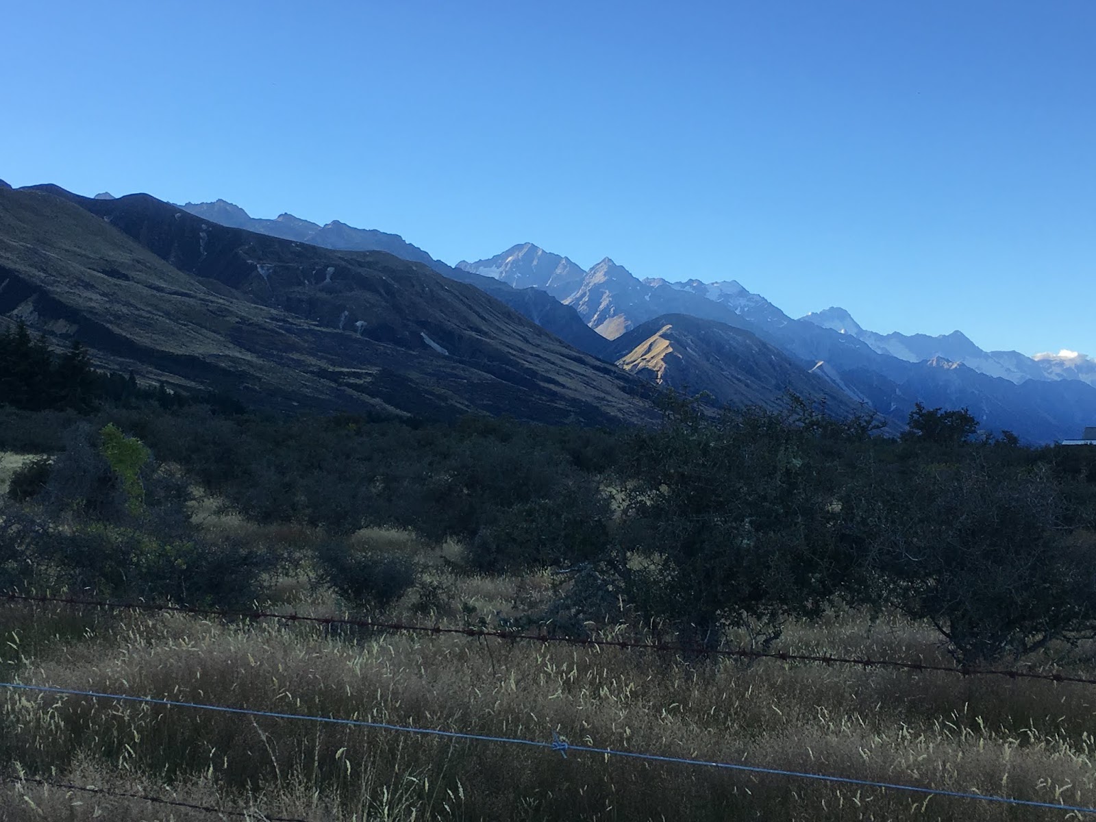
Our trip from Ranfurly to Dunedin to see Clark and Sue was marred by a mutual marital volcanic eruption followed by steamed up, silent lava flow ... Explanation: we had info from Judy that there was a lovely walk to do around Sutton Salt Lake near Middlemarch, and David had carefully found the directions on google maps on his phone. However, he managed to misread his map and we missed the turning. I was OK about that, but David fretted and spent the next several minutes trying (with his eyes focused only on the phone's screen) to work out why/where he'd gone wrong. Meanwhile we were travelling through some pretty amazing countryside and I was pointing this out to him, AND HE WAS IGNORING ME and the scenery. AAARRRGGGHHH!!!
There were several kms of this kind of scenery - all lost on one DMcD

As was this ...

And this.

 Volcanic eruption ensued, lava did a silent rumble and boil, and then a VERY loud silence reigned, until we got to Mosgiel to empty the toilet cassette. We decided to normalise relations seeing as we were heading to stay with Clark and Sue, and it doesn't do to turn up mid-argument! His upset was that he'd really wanted to do the walk, mine was that we had driven through this countryside before (2001) and I wanted him to share the nostalgia and the views.

Well, it is unlikely to be our last trip to these parts, so we will get to see it all again and do the walk.

We found our way to C&S's place via the back route to Opoho - over what we later discovered is called Three Mile Hill - very steep and winding. A good introduction to Dunedin, actually which is about as hilly as Wellington - although admittedly the streets are wider.

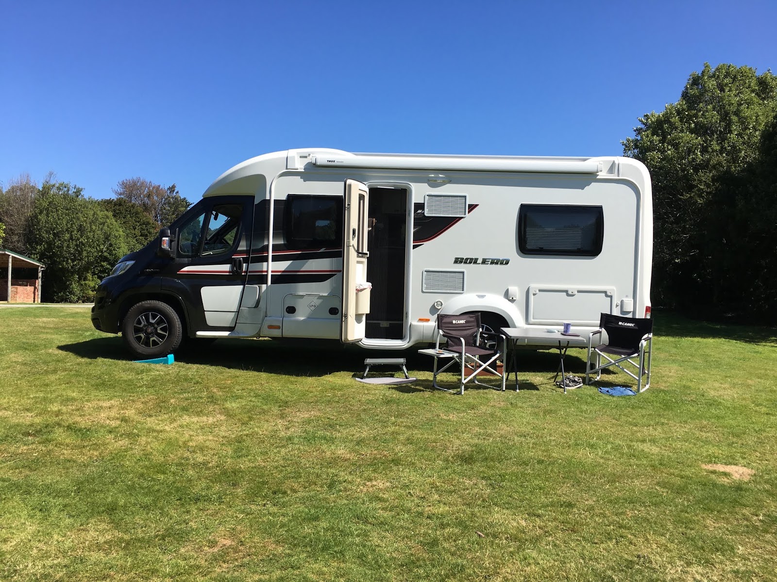
Clark had saved us a park outside their house by putting his car smack bang in the middle of the space, so while we weren't sleeping on board, the motorhome was safe, esp with its mirrors tucked in. Mel came in to join the party, and I'd have to say that while Sue was a fan, Clark was a bit standoffish at first.

Sue and Clark took us (but not Mel) down to Port Chalmers to see not one, but two cruise liners. The Viking one would have looked huge enough if it wasn't moored up next to the Princess line ship - the latter was about 8 storeys high (I will check the photos and correct if required).
I think it's about 8 storeys of cabins, but cannot be sure from the distance. Still and all, it was a VERY big ship!

David, Sue and Clark looking down over Port Chalmers to watch the smaller liner heading out and away.

These chickens were very friendly - cupboard love. They also defy death every time a car arrives in the carpark as they come cadging for food regardless of where the driver plans to stop!

Then there was a trip to a brewery bar for a drink - a VERY nice chardonnay for me, that I need to find and purchase much of.

Home for a yummy dinner, and both recipes have been added to the file. A Vietnamese chicken salad and a chocolate flan, accompanied by lots of reminiscing and catch ups about mutual friends and former teaching colleagues.
While all 3 of us were lazily waiting for Sue to finish prepping dinner, Mel and Clark got acquainted - although Clark is trying to pretend they are not. My question from across the room was 'Where is Mel's hoof?'

Sue was very keen that Mel be properly fed with bread - which she thought was more appropriate goat fare than chicken salad, given goats are vegetarian.


When we first met Clark he was principal at Mosston School just outside Wanganui - a small two-teacher country school. At one of his first assemblies he asked kids what they had done in the holidays and one boy told him he'd caught his first fish. Clark asked what kind of fish, and the boy said 'My dad says it was a fucking fluke'... It still makes me laugh.

In the morning I noted that David had used Mel to store his socks on overnight. Oh the humiliation and loss of dignity!

It was great to catch up with them - we haven't seen them since 1994, the three of them worked out. When we were in Queenstown with Mum and my aunt Molly on Molly's big OE, David and I went to see C&S at C's sister's place apparently - I don't remember that visit at all - oh dear.

But it will not be left for 24 years again - after all by then Clark will be 96, and David and I will be coming up to 94 and I'll be 92 - Sue of course, who is significantly younger than any of us, will still be sprightly and youthful! (Note: I think Sue is 8 years younger than Clark, but as the evening wore on, the age difference was increased incrementally till we settled on her being about 30 years younger - the fact that she looks that much younger than all of us, did contribute to that riff.)

C&S had given us some info about the Catlins from their own experiences and so we headed first for Lake Waihola - I am sure that is an old adulteration of a Maori name (as is Otago). The camp was very 1950s-ish with beside us a small bright pink caravan complete with pink plastic flamingo ...
Notes about Lake Waihola:
1 The fish and chip shop on the main road does very yummy F&C - we had blue cod.
2 The petrol station is multi purpose - we were able to swap our empty gas bottle, fill with diesel, fill with potable water and empty the loo.
3 On weekends, it appears that Lake Waihola is a destination for many people including on the Sunday we were there, a group of noisy young men with noisy cars and noisy music ...

The lake is very attractive and I gather from David that it is used for rowing events.
We left the campsite and had brekkie by the lake. Those grapefruit are off Joy and Grahame Biby's tree  - very yummy!

A good place for breakfast looking out across the lake.

Quite a long train, by NZ standards ...


David was keen that we head over to Taieri Mouth settlement to sit and work out where we would go for the next few days. Little did we know that the drive there was a VERY VERY high hill between Waihola to Taieri Mouth - it was 1000 feet up and down.

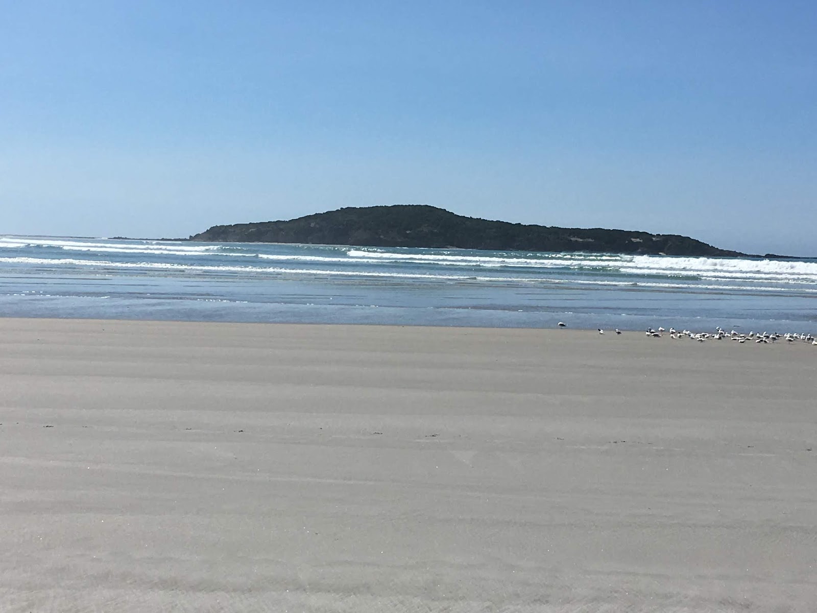
But when we got there we thought what a beautiful place it was, so decided to stay on overnight.

Howzat for a beach?

I call this 'Still Life with Sand'
The beach to the south
This island, the name of which I cannot remember, is a bird nesting sanctuary. It is only accessible at low tide.

The bread was a bit stale so what to do with it? The ham, cheese and tomato toasted sandwiches for lunch were very good.

Mmmm!!


We also went for a walk upstream alongside the river - there is a lookout/bluff about 2 hours in, but we only did 30 minutes of the walk. Back in time for chardonnay o'clock and a discussion with Joyce and Alan who were parked up next to us.

And now, at the time of writing, but not publishing, here we are in Owaka, and it is distinctly chilly at the moment. It is down to 15 deg C. Mind you, I am not complaining as it is certainly preferable to the high 20s and 30+ temperatures of the last couple of weeks!

Our current thinking is that we will use this as a base for the next two or three days - we have been allocated a pink traffic cone to put on our spot, if we drive out for the day. Yay!!! We probably need to buy one for ourselves to use when we stay at NZMCA camps and want to head out for the day. I think I'll try to get one from the Safety Shop in Paraparaumu where I got my steel capped boots, pink helment and pink hi-vis jacket!